Mainland North America. Relief of North America Geographical location of North America
Topic 3. North America
History of the development of North America
Tectonic structure of North America
The ancient North American Plate occupies the interior of the continent, except for the Cordillera and Appalachians and the southwestern part of the Canadian Arctic Archipelago. It accounts for ¾ of the mainland and part of the islands. The Canadian Shield occupies the northeastern part of the platform with the basement reaching the surface. The North American Plate is the remaining southwestern part of the platform, where the basement is overlain by Paleo-, Meso-, and Cenozoic sediments. Similarities with the Russian Platform and the Baltic Shield.
In the northeast and southeast, the platform is closed by Paleozoic structures. Caledonides: Northern Appalachians, northern and eastern Greenland, on the island of Newfoundland. Hercynides - in the southern Appalachians, Boston and Ouachita mountains and in the north of the Canadian Arctic Archipelago.
In the west is the Meso-Cenozoic geosynclinal Cordilleran region, which continues further south into South America. This area includes the islands of the West Indies.
Relief of North America
Within North America, four large morphostructural regions can be distinguished, with different tectonic regimes and, as a consequence, different character of megarelief forms.
1. Plains and hills of platform areas (northern, central and southern parts of the continent) stretch from the Arctic to the Gulf of Mexico. Includes most of the Canadian Shield, the North American Plate, and the Hercynian Fold Plate.
The largest geomorphological region of this territory is Laurentian Rise, occupying the entire continental part of the Canadian Shield. Where rocks of great strength enter the surface, low, steep ridges arose. All this gives the hill a wavy character. This undulation is complicated by glacial and water-glacial forms - moraines, drumlins, eskers. Bedrock, coming to the surface, forms sheep's foreheads, curly rocks. An indispensable element of the landscape is lakes. The average height is 300-400 meters. The lowlands of Hudson Bay and Mackenzie are adjacent to the Laurentian Upland. The surface is completely flat, swampy. The forms of glacial accumulation are clearly expressed. Due to the spread of permafrost, thermokarst processes have developed. On the Banks and Victoria islands and on the Melville and Boothia peninsulas, areas of basement plains alternate with stratified lowlands and plateaus up to 500 m high.
Central Plains(in the USA - lowlands) with a height of 200 to 500 m, correspond to the southern part of the North American platform, composed mainly of layers of Paleozoic sedimentary rocks. Rocks form anteclises and syneclises. Large anteclises form highlands or lowlands (Ozark highland - 760 m). Syneclises are less pronounced; cuestas are formed in their marginal parts. The cuesta ledge made of Silurian dolomites is very interesting. It stretches from the Appalachian foothills to the northwest for more than 800 km. Between Lakes Erie and Ontario, the famous Niagara Falls tumbles down from this ledge.
In the northern part of the plains, there are clear signs of recent glaciation: terminal moraine ridges, outwash plains, and accumulations of kamas. To the south 44-42 0 N. glacial deposits are covered by loess. The surface of the watershed areas becomes flat, but there are a lot of ravines in the riverine areas.
To the south of 45 0, along with erosional dissection, karst landforms are widely developed. Near the southeastern edge of the Central Plains lies the world's largest cave, Mammoth Cave. The length of its underground galleries reaches 225 km.
Great Plains They are distinguished by a significant thickness of sedimentary rocks, a high surface height and represent a system of stepped strata plateaus with a general surface level that decreases from the Cordillera to the east. A striking feature of the relief of the Great Plains is the combination of various erosion forms: gullies, ravines. The slopes of neighboring ravines, intersecting, form an endless interweaving of ridges there. These are “bad lands”, completely unsuitable for economic use. The north of the plains was influenced by glaciation; there are many lakes and sandy-clayey material. In the middle part of the plains lies a thick layer of loess-like loams. In the southern part, the plains are dissected by a network of gorges, up to 200-300 meters deep. There are also karst forms here.
Coastal lowlands – their structure involves layers of Cretaceous, Paleogene, Neogene and Quaternary sediments lying on the Hercynian base. The tilt of the strata to the south caused the formation of cuesta ledges. Significant waterlogging. The presence of extensive lagoons separated from the ocean by sand spits.
2. Revived mountains in the areas of the Precambrian and Paleozoic basement (Greenland and the northeastern part of the Canadian Arctic Archipelago). In terms of the structure of the geological foundation, this area is close to the previous one. Specific forms of megarelief arose due to active young movements of the earth's crust. Large relief forms arose during the formation of the basins of the Arctic Ocean and the adjacent seas. High mountain relief arose on the structures of the Precambrian shield. The East Greenland Mountains are highly dissected mountain ranges with glacial forms, up to 3,700 m high. To the east they are framed by high foothill plateaus. The entire system of mountains and plateaus is dissected by a dense network of fjords.
Another belt of mountains stretches perpendicular to the first along the northern shores of Greenland. Its continuation is the mountains stretching from Ellesmere Island to Melville Island. The uniqueness of the territory is also explained by active modern glaciation. The Greenland ice sheet has a height of 3150 m. Forms associated with frost weathering, thermokarst, and solifluction are widespread on the western islands.
3. Rejuvenated mountains in the area of the Paleozoic basement (Appalachian Mountains). The modern Appalachian Mountains arose as a result of the uplift of part of the Paleozoic fold belt in the Cretaceous-Cenozoic time. The belt of uplifts covered only the western edge of the mountains and the part of the platform adjacent to the west. The predominant surface type of the Appalachians is denuded plateau. The mountainous relief is confined to the Lower Paleozoic folded structures. Such is the group of block and folded-block ridges, known as the Blue Ridge, up to 2040 m high, as well as the White and Green Mountains. The mid-mountain terrain is located west of the Blue Ridge and is represented by wide longitudinal valleys and short narrow ridges. The mountain ranges are bordered by foothills - the Appalachian Plateau in the west by the Piedmont foothill plain. The topography of the northern Appalachians was greatly altered by the Quaternary glaciation.
Climate of North America
Climate-forming factors
a) Features of the position of the continent: most of it is located in temperate latitudes, it enters the Arctic latitudes as a dissected island part, and it enters the hot zone (mostly in the subtropical zone) as a tapering and island part.
b) Features of the circulation of air masses associated with the position of the continent (in temperate latitudes, westerly transport).
c) The originality of the orography - the trench-shaped relief pattern causes unstable weather in the middle meridional strip, the internal intermountain depressions of the Cordillera are isolated from sea air masses; The meridional location of the ridges limits influence from the west. Cold waves can reach the Gulf Coast, where heavy frost falls at night; With westerly winds, warm air (this wind is called “Chinook”) comes to the Great Plains, which prevents the formation of stable snow cover in winter.
d) Ocean currents.
e) The nature of the dissection of the coasts also brings originality to the climatic features.
Pressure systems
IN winter time due to overcooling of the land, three baric maxima are established: Canadian (near the Arctic Circle), North American (above the mainland in the western part of 40 0 N), and Greenlandic (above Greenland).
In areas where warm currents dominate, there are baric lows: the Icelandic low is pronounced, the spurs of which enter the Strait of Davis; and at the same latitude the Aleutian minimum, which is weaker than the Icelandic one, since the Alaskan Current is weaker than the Gulf Stream. The Aleutian Low has less of an impact on the mainland because it is isolated from the interior by the Cordillera.
In subtropical latitudes, the North Atlantic and North Pacific maxima (in the zones of the Canary and California cold currents) occupy an extreme southern position and are weakly expressed, so the pressure in their areas is lower than above the mainland. These highs converge with the Canadian and North American highs.
IN summer time– due to the warming of the continent, a pressure depression (North American minimum) is established over its southwestern part, and the North American and Canadian maximums disappear; the pressure maximum will remain over Greenland due to the dominance of low temperatures all year round.
The Icelandic low weakens and shifts to the west - it gives a spur to the northeastern part of the continent (near the southwestern edge of Greenland), where at this time relatively warm air masses are formed compared to the ice-covered Greenland and Hudson Bay. The Aleutian minimum practically ceases to exist due to the heating of adjacent land areas.
Oceanic anticyclones (North Atlantic and North Pacific) shift from subtropical latitudes north to 40 0 N, and the Hawaiian High, intensified by the cold California Current, has a special influence on the western shores of the continent.
Air circulation
Continental air masses form over the continent: temperate and tropical. Due to the meridional location of the ridges, the boundary of these air masses easily moves either north or south, causing sharp cooling or warming in the interior regions.
Marine air masses penetrate deeper into the continent from the east than from the west.
In winter time– sharply uneven heating of the southern part compared to the sharp cooling of the northern part. A pronounced Icelandic low reaches the northeastern part of the continent, which causes cyclones along the eastern coasts and sometimes inland. The weaker Aleutian Low brings cyclones only to a narrow coastal strip of sunken shores. Weakly pronounced subtropical highs over the oceans in the presence of an anticyclone over the mainland lead to the transfer of continental air masses to the Atlantic. But due to the instability of the anticyclone, this monsoon wind pattern is not clearly expressed.
Central America and the West Indies are located in the trade wind circulation zone under the influence of northeastern winds in the region of the North Atlantic High.
In summer time– The North Atlantic High in its northern position extends to the southeastern edge of the continent. As a result, marine tropical air masses rush northwest and north into the pressure depression zone over the mainland, creating a monsoon circulation over the south of the mainland. This air flow then rushes to the northeastern edge of the continent, where it is sucked in by the spurs of the Icelandic Low.
The North Pacific anticyclone affects only the northwestern edge of the continent, where, as a result of planetary circulation, marine air masses of temperate latitudes arrive.
In Central America, tropical air masses enter the northern part from the Atlantic, and the southern part from the Pacific Ocean in the form of the southwestern equatorial monsoon.
Temperature distribution
IN winter time– the greatest frosts are observed in the center of Greenland (average -55 0). There is no pole of cold in North America. In the interior regions of the continent, frosts are more severe than on the coasts: in the Hudson Bay area -25 0, at the same latitude to the east -15, on the west coast 0 0 due to the Alaska Current. In the interior regions, the 0-th isotherm reaches 35 0 N latitude, and reaches the eastern coast near New York. At 30 0 N temperatures on the coasts level out (12 0). In the southern parts of Central America in winter the average temperature reaches 25 0.
IN summer time– negative temperatures (up to -15 0) remain in Greenland. On the mainland they vary from 5 0 in the north to 25 0 in the south. The “Pole of Heat” is located over the southern part of the Cordillera. The highest temperature in the Western Hemisphere was recorded in Death Valley (+57 0). The second area of temperature anomalies in the summer months is the northeastern part of the continent. The isotherms, moving to the south, reflect the strong influence of the cold ocean here. In mountainous regions, the temperature decreases with height, with the exception of warmed intermountain basins.
Precipitation distribution
In the interior of the continent, the amount of precipitation decreases from east to west and from south to north.
More than 1000 mm/year is obtained by:
a) Pacific coast north of 40 0 N latitude. (up to 2000 mm), precipitation is brought by southwestern winds under the influence of the Hawaiian anticyclone;
b) The southeast of the mainland and most of the West Indies (1000-2000 mm) - due to summer rains brought by the trade winds due to the intensification of the North Atlantic High.
Less than 300 mm/year of precipitation is received by: the northern parts of the Arctic archipelago and the northern coast of California (a general planetary pattern).
Climatic zoning
1. Arctic belt occupies Greenland, most of the Canadian Arctic Archipelago and the northern coast of the mainland to the Arctic Circle. Arctic air masses dominate here all year round. As a result, in winter there are stable frosts from – 35 0 to – 55 0, and in summer the temperature almost never rises above 0 0. There is a lot of cloudiness, fog and snow storms all year round. Polar night up to 5 months. Precipitation 300 mm. Humidity coefficient 1-2.
2. Subarctic belt washed in a continuous wide strip, in the south it reaches 58 0 N latitude. and only in the far west, due to the influence of the Pacific Ocean, does it rise to about 62 0. . The amount of precipitation throughout the belt is low. There is a seasonal change in air masses: arctic air dominates in winter, temperate air dominates in summer. White nights are characteristic, and in winter the days are very short. The following areas are highlighted:
Oceanic areas in the west and east in the coastal margins of the continent. There are 2 of these areas, but they are qualitatively close. Winter is measured by the influence of the oceans: -15-20 0, in summer + 15+20 0. Humidity coefficient 1.5-2.
Continental region in the center of the continent. Continental air masses dominate: moderate in summer, arctic in winter. Winter is more severe (-30 0). In summer, temperatures are close to those in oceanic areas. Humidity coefficient 0.8-1.5.
3. Temperate zone It crosses the mainland in a wide strip, its border in the south reaches 42 0 in the west and 38 0 in the east. Temperate air prevails all year round, but in summer there are occasional intrusions of tropical air masses from the south, and in winter – arctic air masses from the north. The weather is unstable. The following climatic regions are distinguished:
Atlantic region (northern Appalachians, Labrador and New Foundland). In winter, continental air masses dominate and frosts can reach -20 0. In summer, oceanic air masses bring precipitation from the Atlantic, north of 40 0 N latitude. under the influence of the Labrador Current, summers are cool, to the south - under the influence of the Gulf Stream - above 20 0. Fogs are frequent on the coast. Humidity coefficient 1.2 -1.6.
Continental region (inland regions, including the Cordillera, which are sometimes separated into an independent region). Severe winter is associated with an anticyclone; the invasion of cyclones from the north brings snow storms. In summer, temperatures are less stable due to air penetration either from the north or from the south. In the mountains, the altitudinal climatic zone is clearly expressed, as well as the climatic features of the slope exposures. Humidity coefficient 08-1.2. The Great Plains are frequently affected by drought. When cyclones pass, strong dry winds occur here. Fluttering loose sands, they lift hundreds of tons of dust into the air and carry it to the eastern shores of the continent. The clouds of dust sometimes become so thick that the streets have to be turned on at noon. Cyclones are associated with frequent destructive tornadoes (tornadoes) that occur during the passage of frontal regions. Tornadoes have a diameter from 10 m to 1.5 km. The speed of the wind directed upward in a spiral around the vortex axis often reaches 100 m per second
The Pacific region (the coast west of the Cordillera) has an oceanic climate as a result of the year-round dominance of oceanic air masses. In winter the temperature is about 0 0 and there is heavy rainfall, the summer is cool. Humidity coefficient 1-5.
4.Subtropical zone extends in the south to 30 0 N, approaching the Florida and California peninsulas. Seasonal change of air masses: tropical air dominates in summer, air of temperate latitudes dominates in winter. The following climatic regions are distinguished:
Southeast coast region. A subtropical monsoon climate dominates here under the influence of seasonal changes in winds. Summer precipitation, brought by easterly winds, predominates. Humidity coefficient 1.2 -1,
Area of uniform moisture. Summer monsoon rains coming from the Gulf of Mexico are combined with winter cyclonic precipitation. Summer is humid due to south-easterly winds, winter with sharp cold snaps and snowfalls.
Lakes of North America
1. Lakes that arose as a result of Quaternary glaciation and are located in the north of the continent - on the Laurentian Upland and in the adjacent Central and Great Plains. The contours of a significant part of them are oriented towards the centers of degradation of the Wisconsin glaciation. They are all fresh, flowing. The most significant lakes of this type are the Great Bear, the Great Slave, Winnipeg, Athabasca, Olenye, Winnipegosis, Manitoba. On the shores of the Arctic Ocean along with glacial there are many small rounded thermokarst lakes There are especially many of them on Victoria Island and in northern Alaska.
2.Mountain glacial lakes Canadian Rockies and Fraser Plateau. These are narrow finger-shaped lakes located in trough valleys.
3.Volcanic lakes The Cordilleras are deep and formed in calderas and craters of the Aleutian Range and Cascade Mountains. The most famous Crater Lake in the Cascade Mountains has a depth of about 600 m.
4.Lava dammed lakes found in the southern Mexican Highlands, many of them dry out. A similar lake is Yellowstone in the Rocky Mountains.
5.Residual lakes preserved in tectonic basins of the Great Basin. Such are the Great Salt Lake, Utah, Pyramid, Sevier. Most of them are relics of very large freshwater lakes of Pleistocene time. Deprived of flow into the ocean, almost all of them (except Lake Utah, which has flow into the Great Salt Lake) became salty. The salinity of the water in the Great Salt Lake is 270%.
6.Lagoon lakes found in the oceanic parts of the Coastal Lowlands. Many of them have complex origins. Thus, in the Mississippi delta, soil subsidence plays a major role in the formation of lakes (the largest subsidence lake is Pochartrain).
7. On the Florida Peninsula there are small, rounded and deep karst lakes.
Topic 3. North America
Geographical location of North America
Geographical location - all in the northern hemisphere and the entire continent in the western hemisphere. The continent is widest in temperate latitudes.
Extreme points: in the north - Cape Murchison (on the Boothia Peninsula), in the south - Cape Maryato, in the east - Cape St. Charles, in the west - Cape Prince of Wales. The area including the islands is 24 ¼ million km 2, without the islands 20 1/3.
The landscape of North America was formed by a variety of geological processes. Some of them continue to this day. What are the features of the relief and its specificity - the material presented will help answer these questions.
Relief of North America
The relief of North America is diverse and contrasting. The continent lies on the lithospheric plates - North American and Caribbean. The western boundary of the last plate passes through Eurasia.
The central region has flat plains interspersed with vast expanses of hilly terrain. In the east they are adjacent to the Appalachian Mountains. In the west, the plains are adjacent to the Cordillera mountain ranges.
The relief features of North America are determined by the specific geological development of the territory, which is 4.5 billion years old.

Rice. 1. Relief map of North America
The peculiar foundation of the continent is the ancient North American Plateau, whose relief is expressed by plains of varying heights, the shapes and outlines of which resemble waves.
TOP 4 articleswho are reading along with this
External processes played a central role in the formation of the relief. Many millennia ago, the areas located in the northern part of the continent were a glacier.
The glacier that existed at that time was twice the size of Australia, and its power was such that this giant easily polished the surface of rocks and leveled the ground beneath it.
The formation of the landscape was influenced by the following factors:
- impact of surface and groundwater;
- wind.
Relief structure of North America
The structure of the continental surface is divided into the following parts: northern and central, where the plains are located, eastern - with the Appalachian mountains, and western - with the Cordillera. This is the largest mountain system in the world.
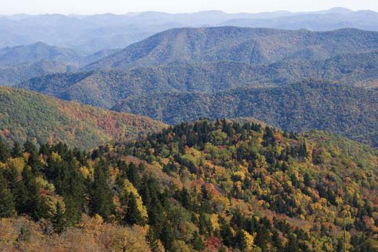
In the northwestern part of the continent, large landforms of North America are represented by mountain ranges that reach maximum heights. Mount McKinley located here (6193 m) is the highest point in the Cordillera and North America.

Rice. 2. Mount McKinley
Together with the South American Andes, these heights make up the longest mountain chain in the world - over 18 thousand km!
Mountain building in the Cordillera occurs continuously. This is indicated by the constant activity of volcanoes, which is accompanied by frequent earthquakes. The active volcanoes here are:
- Orizaba (5700 m);
- Popocatepetl (5452 m);
- Colima (3846 m).
Seismically active areas of the continent are located on the western and Pacific coasts.

Rice. 3. Vulcan
The plains were formed on tectonic plates and occupy two-thirds of the surface. To the south of the Laurentian Upland stretch the Central Plains with average heights of 200-300 m. To the west of the Central Plains along the Cordillera, the Great Plains stretch in a strip. The surface is dotted with river valleys and ledges into separate massifs and plateaus.
To understand the relief of North America, you need to have an idea of the processes affecting the surface of the platform, which has been destroyed and leveled many times.
What have we learned?
From an article on geography (7th grade), we learned what factors influenced the relief features of North America. What natural processes occur in this area. What part of the continent is occupied by mountains and what part is plains. Why mountain building is a constant and continuous cycle. It was also possible to obtain information about the age of the territory on which the mainland is located. It was possible to find out what explains the diversity and contrast of the relief characteristic of this territory. The location of the highest peak in the Cordillera and North America has been clarified.
Test on the topic
Evaluation of the report
Average rating: 4.5. Total ratings received: 179.
Relief - all this is studied today at school in geography lessons. Knowledge of these topics is necessary not only for passing the exam, but also for overall development. After all, each of us must understand what the surface of the planet on which we live is.
North America, the topography of which we will consider in this article, resembles South America in the type of vertical division. A powerful belt stretches along the western coast for 7000 km. The eastern half of this continent is predominantly flat. All this suggests that the relief of North and South America has significant similarities. However, there are significant differences between these continents. In particular, the Cordillera as a mountain system is much wider and more complex than the Andes (also called the Andean Cordillera). They consist of a whole system of ridges, differing in tectonic and geological structure, which are isolated.
Eastern belt
Five orotectonic longitudinal belts are clearly visible throughout almost the entire length of the Cordillera. The first of them, the eastern one, is the ridges of the Laramie fold: the Mackenzie Mountains, the Brooks Range, the Sierra Madre Oriental Range, the Rocky Mountains. The latter can be divided according to orographic features into two parts: southern and northern. The border between them is the Yellowstone Plateau. The clear straightness of the forms is a striking orographic feature.
Front Range of the Rocky Mountains
The leading ridge of the Rocky Mountains (North America) has the following relief: it stretches for almost 2000 km in a straight line, striking with the continuity, integrity and uniformity of its geological structure. The mountain range, clearly defined, is crowned by steep, high peaks that reach heights of 4000 m. It gradually descends in the east to the Great Plains. The forward ridge in the west is bounded by a tectonic fault in the northern part. In the middle part the mountains are lowered. They are crossed by the Peace River, which is one of the sources of the Mackenzie River. The forward ridge in the southern part is expanding. It is divided into separate ridges, the height of which is significant: Lewis, Caribou, Selkirk. The largest peaks of the Front Range are located in this part. These are Mount Robson (height 3954 m) and Mount Columbia (3747 m). Alpine landforms of North America are typical of the Front Range. It is also characterized by difficult terrain and significant glaciation.
Rocky Mountains in the South
The Rocky Mountains do not form a single mountain range in the southern part. Here they consist of separate massifs, sometimes isolated and separated by “parks” - wide basins, which are plateau-like areas that connect the Great Plains with the Great Basin. Some of the ridges (Sangre de Cristo, Wasatch) stretch almost from north to south. Others (for example, Uinta) - in a west-east direction, perpendicular to them. The significant height and width of this mountain belt compensates for the lack of continuity. The border between and the Rocky Mountains is very clearly defined: a steep wall - a mountain slope. The southern segment is typical epiplatform mountains that were formed after the activation of the edge of one of the ancient platforms.
Belt of internal plateaus and plateaus

The next one is a belt of internal plateaus and plateaus formed in the Nevadan fold on the North American continent. The relief is characterized by folded Nevadan structures represented by peniplains. Within this belt, there are also plateaus that are confined to the “fragments” of the North American ancient platform and are sandwiched by the Cordillera ridges (Northern Massa, Colorado Plateau). The largest intermountain plains are: Fraser, Yukon, Great Basin, Columbia, Northern and Central Mass, Colorado.
Big Pool
The Great Basin is a denudation plateau with the largest area. This territory, whose width reaches 800 km, generally represents an alternation of flat and mountainous surfaces with a predominance of the former. On average, the surface of the plateau is raised by 1500 m. However, there are large fluctuations in heights. The plateau is crossed by parallel ridges with altitudes of approximately 3 km (Wheeler Peak - 3982 m). Deep depressions called bolsons lie between them. These are semi-closed and closed basins, which are areas of internal drainage. Death Valley is one of them (-85 m).

Remnant peaks are often found here (including volcanic cones).
Colorado Plateau and Grand Canyon
This is one of the unique corners of our planet that North America is famous for. Its relief is very beautiful. In its geological structure (undisturbed horizontal plates of mountain sedimentary rocks of different ages - from Upper Paleosian to ancient, lying on a crystalline foundation) this plateau is similar to the North American platform. Its surface is a hilly plain, the heights of which reach 3860 m.
The attraction of the plateau is the Grand Canyon (North America). The terrain and climate attract many tourists to this place. The Grand Canyon (pictured below) was formed near the Colorado River, in its middle course. Its depth reaches 1800 m, with a width of 8 to 25 km at the plateau level and up to 1 km at the bottom level. Sheer slopes of interesting, bizarre shapes are characteristic of the Grand Canyon. They arose as a result of processes of erosion and weathering. A winding narrow channel is cut into the crystalline base.

Inner mountain belt
The third belt - the inner mountain - is the belt of Nevadan ranges: Coast Range, Alaska Range, Cascade Mountains, Sierra Nevada, Transverse Volcanic and Sierra Madre Occidental. These mountain ranges are distinguished by their straightness. Igneous rocks predominate in their structure. - a batholith with volcanic cones set on it. The Sierra Nevada range is an asymmetrical giant crystalline batholith with gentle western slopes and steep eastern slopes.
Synclinorium belt
The fourth belt is the synclinorium belt. This is a subsidence zone that took shape in the Neogene. Part of it is currently represented by various sea bays and straits. On land, this is Death Valley, the Great California Valley, and the lower reaches of the Colorado River.
Extreme western belt
The fifth belt is the extreme western one. This is the coastal belt of such ranges as the Aleutian (there are 25 active volcanoes here), the Kenai Peninsula, the Island Range with Victoria Peak (height - 2200 m), the Chugach Range, the Victoria Peninsula, the Coast Ranges, and the Southern Sierra Madre Range. All of them are classified as medium-altitude, only the most prominent peaks are higher than 2 km.

Depending on the degree of glaciation, the severity of orographic longitudinal belts, tectonic and erosional division, the Cordillera is divided into 4 morphostructural regions: the Cordillera of Mexico, the Cordillera of the USA, the Cordillera of Canada and the Cordillera of Alaska.
Eastern part of the mainland
What is the topography like in eastern North America? Let's figure it out. As we have already noted, the landforms of North America are mostly flat in the eastern part of the continent. These are mainly elevated (Central, Laurentian) and high plains. The lowlands are located along the coastline: the Mexican, Atlantic, Hudson, and Mississippi in the lower reaches of the river of the same name.
Appalachian mountain belt

In North America, unlike South America, another mountain belt stretches along the east coast - the Appalachian Mountains. This is a system of mountain ranges located from the Gulf of St. Lawrence to approximately 33-32 0 N. sh., that is, almost 2300 km. is the northern link. The Appalachians are epiplatform, medium-altitude mountains. The significant difference between the southern and northern parts of this mountain system was determined by the features of the tectonic and geological structure. The Hudson Graben is the boundary between the Southern and Northern Appalachians. The northern Appalachians as a whole are undulating plateaus. Individual mountains, ridges or mountain ranges rise above it. The northern Appalachians were covered by the Quaternary glaciation. Therefore, the shapes of the mountains now are flat; only on the highest peaks there are circuses with steep walls.
Southern Appalachians
The Southern Appalachians are distinguished by alternating long parallel valleys and ridges. From the east and west there are plateaus along the foot of the mountains. This is the Piedmont to the west - a denudation flat plain formed by Early Cambrian crystalline rocks. From it in the west, a chain of mountain ranges rises steeply, almost continuous (Kokhuta, Unaka, Cherny, Dymny, Bolshoi, Goluboy, etc.), the height of which is 1-1.5 km. These are “ancient mountains” - dense cores of the Caledonides, prepared by denudation.
Belt of ridges and valleys
One of the most remarkable areas of the Appalachians is located to the west of them. These are the so-called Young Mountains, or the Belt of Ridges and Valleys. Here are some interesting features of the relief of North America. The entire territory is composed of sedimentary rocks from the Paleozoic era: the ridges are shales and sandstones, the valleys are dolomites and limestones. Stretched for hundreds of kilometers from southwest to northeast along the strike line of the mountains, wide valleys alternate with flat-topped or narrow ridge-like ridges. At an altitude of 500-600 m lies the bottom of the valleys. The tops of the ridges reach 1-1.2 km. In tectonic terms, valleys are anticlinoria, and ridges are synclinoria. That is, in this place there is a clear discrepancy with the type of tectonic structure of the modern form that the relief of North America has here. A photo of the Appalachian Mountains is shown below.
This is an example of an inverted or inverted type of relief. It is found quite rarely in the mountains and is most prominently represented in the Appalachians. This type of relief, by analogy, came to be called “Appalachian relief.” The belt of “young mountains” is interrupted from the west by the Appalachian Plateau (Cumberland, Alleghany). It is a ledge, the height of which is 300-400 m. This plateau is significantly higher than Piedmont. Its surface at the eastern edge lies at an altitude of about 1.2 km, and at the western edge - 500 m. The plateau is in some places deeply dissected by the valleys of various rivers (gorges with narrow bottoms and steep slopes).
Well, now that the relief of North America has been briefly discussed in this article, we hope it will be easier for you to form your own idea about it.
The nature of the vertical division is reminiscent of South America: along the western coast there is a powerful mountain belt of the Cordillera, stretching for 7000 km; The eastern half of the continent is predominantly flat. Against the general background of similarities, there are also significant differences. Thus, the Cordillera mountain system is much wider and more complex: it consists of a whole system of separate, isolated ridges that differ in geological and tectonic structure.
Almost along the entire length of the mountain system, 5 longitudinal orotectonic belts are clearly visible. The first, eastern belt is the ridges of the Laramie fold region: ridge. Brooks, Mackenzie Mountains, Rocky Mountains, ridge. Sierra Madre Oriental. Based on orographic features, the Rocky Mountains are divided into 2 parts: northern and southern. The border between them is the Yellowstone Plateau. The northern part is represented by the Front Range (Front Range). A striking orographic feature is the clear straightness of the forms. The front ridge of the Rocky Mountains stretches in a straight line for almost 2000 km, striking in its integrity, continuity and largely uniform geological structure. A distinct mountain range is crowned by high, steep peaks up to 4,000 m high. In the east, it gradually descends to the Great Plains. In the west, the Advanced Range is limited in the northern part by a tectonic fault. In the middle part the mountains are lowered and crossed by the Peace River (one of the sources of the Mackenzie River). In the southern part, the Front Range expands and is divided into separate ridges of considerable height: Selkirk, Caribou, Lewis, etc. Here are the maximum peaks of the Front Range, Robson Mountain (3954 m) and Columbia City (3747 m). The Forward Range is characterized by alpine landforms, significant modern glaciation, and the mountains are difficult to pass.
The southern part of the Rocky Mountains does not form a single mountain range, but consists of a number of separate massifs, sometimes isolated from each other and separated by wide basins (parks) and plateau-like areas connecting the Great Plains with the Great Basin. Some of the ridges (Wasatch, Sangre de Cristo) stretch almost from north to south, while others (Uinta) - in a west-east direction perpendicular to them. The lack of continuity is compensated by the considerable width and height of this mountain belt. The boundary between the Rocky Mountains and the Great Plains is very clearly defined: the mountainside is a steep wall. The southern segment of the Rocky Mountains are typical epiplatform mountains, formed as a result of activation of the edge of the ancient platform.
The second belt is a belt of internal plateaus and plateaus formed during the Nevadan folding. The Nevadan folded structures here are represented by peniplains, overlain by clastic rocks carried down from the surrounding ridges, or by volcanic lavas. There are also plateaus within this belt, confined to the fragments of the ancient North American platform, sandwiched by the folded ridges of the Cordillera (Colorado Plateau, Northern Messa). The largest intermontane plains: Yukon, Fraser, Columbia, Great Basin, Colorado, Northern Mass, Central Mass. The largest denudation plateau in terms of area is the Great Basin. In general, this territory, up to 800 km wide, represents an alternation of mountainous and flat surfaces, with the latter predominant. The surface of the plateau is elevated by an average of 1500 m. But the fluctuations in heights are very large. The plateau is crossed by parallel ridges of meridional strike with heights of about 3000 m (Wheeler Peak, 3982 m). Between the ridges there are deep depressions called bolsons - closed and semi-closed basins, which are areas of internal drainage. One of them is Death Valley (-85 m). Outlier peaks (including volcanic cones) are often found.
One of the unique corners of the world is the Colorado Plateau. In terms of its geological structure (horizontal undisturbed layers of sedimentary rocks of various ages from ancient to Upper Paleozoic, resting on a crystalline foundation), it is similar to the North American platform. The surface of the plateau is a hilly plain (with heights of more than 2000 m, up to 3860 m) with individual plateau-like peaks and table-shaped mountains. The attraction of the plateau is the Grand Canyon, formed in the middle reaches of the river. Colorado. Its depth is up to 1800 m, with a width at the plateau level from 8 to 25 km, at the bottom level up to 1 km. It is characterized by steep slopes of bizarre shape, resulting from the processes of weathering and erosion; a narrow, winding channel is cut into a crystalline base.
The third belt is the inner mountain belt of the Nevadan ridges: Alaska Range, Coast Range (Waddington, 4042 m), (Denali (McKinley), 6197 m).
Cascade Mountains (Mount Rainier, 4392 m), ridge. Sierra Nevada (Whitney, 4418 m), Sierra Madre Occidental. Transverse Volcanic Sierra Madre (Orizaba volcano, 5700 m). These mountain ranges are linear and their structure is dominated by igneous rocks. The Cascade Mountains are a batholith with volcanic cones embedded on it. Chr. The Sierra Nevada is a giant asymmetrical crystalline batholith with steep eastern and relatively gentle western slopes.
The fourth belt is the belt of synclinoriums, zones of subsidence, which took shape in the Neogene. Currently, part of it is represented by sea bays (Cook), straits (Shelikhov and others - between the islands of the archipelagos and between the islands and the mainland); on land it is the Great California Valley, Death Valley, the lower reaches of the river. Colorado).
The fifth belt is the extreme western, coastal black belt of the Alpine folded ridges: Aleutian (25 active volcanoes, including Katmai volcano on the Alaska Peninsula, Shishaldin volcano, 2860 m on Unimak Island), Kenai Peninsula , Island ridge (formed by the islands Kodiak Vancouver, Queen Charlotte, Arch. Alexandra, etc.) with Victoria Peak (2200 m) on the island. Vancouver; Chugach Range; Coastal Ranges; California Peninsula; hr. Southern Sierra Madre. These ridges are classified as medium-altitude, only their highest peaks rise above 2000 m.
Depending on the severity of longitudinal orographic belts, the degree of glaciation, erosion and tectonic division, the Cordillera is divided into 4 morphostructural regions: the Alaska Cordillera, the Canadian Cordillera, the US Cordillera, and the Mexican Cordillera.
The eastern part of the continent is dominated by flat terrain, represented mainly by elevated (Laurentine, Central) and high (Great) plains. Lowland plains are located along the coastline: the Hudson, Atlantic, and Mexican, as well as in the lower reaches of the mainland's largest river, the Mississippi.
Unlike the South American continent, North America has another mountain belt stretching along the east coast - the Appalachian. A system of mountain ranges stretching from the Gulf of St. Lawrence to 33-32° N, almost 2300 km. The northern link is about. Newfoundland. The Appalachians are mid-altitude epiplatform mountains. Features of the geological and tectonic structure determined a significant difference between the northern and southern parts of the mountain system. The boundary between the Northern and Southern Appalachians is the Hudson graben. In general, the Northern Appalachians are undulating plateaus, over which mountain ranges, ridges, or individual mountains rise. The latter often represent solid massifs of the most durable rocks. The most typical form in this regard is the city of Monadnock, whose name has become a common noun for remnant mountains. The Quaternary glaciation covered the Northern Appalachians. Therefore, the shapes of the mountains are gentle; only on the highest peaks are circuses with steep walls preserved.
The southern Appalachians are characterized by an alternation of long, parallel ridges and valleys. From the west and east, plateaus stretch along the foot of the mountains. In the west, this is the Piedmont - a flat denudation plain formed on peniplanned Caledonian folded structures, composed of crystalline Early Cambrian rocks. To the west of the Piedmont plateau, an almost continuous chain of mountain ranges (Blue, Bolshoi, Dymny, Black, Unaka, Kohuta, etc.) rises steeply, 1000-1500 m high; this is an area of ancient mountains, dense cores of the Caledonides prepared by denudation. West of the ancient mountains lies one of the most remarkable regions of the Appalachians, the so-called Belt of Ridges and Valleys, or Young Mountains. The entire territory is composed of sedimentary rocks of the Paleozoic: the ridges are sandstones and shales; valleys - limestones and dolomites. Wide valleys, stretched along the line of the mountains for hundreds of kilometers from northeast to southwest, alternate with narrow ridge-like or flat-topped ridges. The bottom of the valleys lies at an altitude of 500-600 m, the tops of the ridges at an altitude of 1000-1200 m. In tectonic terms, valleys are anticlinoria, ridges are synclinoriums. Those. here the discrepancy between the nature of the tectonic structure and the sign of the modern landform associated with it is clearly visible. This is an example of an inversion, or reversed type of relief. In the mountains it is relatively rare. It is most clearly represented in the Appalachians and, by analogy, this type of relief is called the Appalachian relief. From the west, the belt of young mountains is limited by the Appalachian Plateau (Alleghany, Cumberland). In relief, this is a ledge 300-400 m high. The Appalachian plateau is much higher than the Piedmont: at the eastern edge its surface lies at an altitude of about 1200 m, at the western edge - 500 m. The plateau is composed of Upper Paleozoic sedimentary deposits, occurring in horizontal layers. In some places the plateau is deeply dissected by river valleys (gorges with steep slopes and narrow bottoms). The relief of the watershed areas is flat; karst is developed as a result of the widespread distribution of limestones.
(according to E.M. Zubaschenko)
Due to the variety of landforms, North America has large reserves of minerals, many of which are classified as rare.
Mainland Plains
The continental plains are located on the very ancient North American Platform, which consists of Precambrian crystalline shields. The Northern Plains are located within the Canadian Shield.
On these plains there are a large number of fresh lakes, which form the southern and western border of this shield. The lakes were formed here as a result of hollows being plowed out during the Ice Age.
To the south are the central plains, the average height of which is 200 m above sea level. These plains are composed of continental and marine rocks.
In the extreme south, the central plains give way to the Mississippian Lowlands. From the central plains to the foot of the Cordilleras, vast territories of the Great Plains stretch.
These plains have a stepped shape, their height above sea level increases in a westerly direction.
Mountains of North America
The Appalachian Mountains are located in the southeast of the continent. They belong to the category of revived folded-block mountains, which were formed during the era of the Hercynian orogeny. The highest point of this mountain system is Mount Mitchell, whose height reaches 2300 m.
A characteristic feature of the Appalachian Mountains is their rounded peaks and gentle slopes. Along the Pacific coast of North America are the Cordilleras.
The Cordillera mountain system is divided into two parts, which are connected by highlands and high plateaus. The highest peak of the Cordillera is Mount McKinley (6195 m).
The formation of the mountain system took place in two stages. The formation began in the Mesozoic era; the mountains were finally formed in the Middle Cenozoic.
The Cordillera mountain system includes the volcanic Mexican Highlands, Colorado Plateau, Mexican Plateau, and Great Basin Plateau.
Minerals of North America
In the depths of North America there are huge reserves of a wide variety of minerals. Large reserves of non-ferrous and ferrous metal ores, nickel, uranium and gold are concentrated in the northern territories of the mainland.
The largest iron ore industrial region is located on the shores of Lake Superior. Oil-bearing areas are located in Alaska, on the shelf and coast of the Gulf of Mexico, in the Great Plains, and on the coast of the Arctic Ocean.
In the valleys of the Appalachians there are coal basins. The Cordilleras are home to springs of non-ferrous metal ores: silver, zinc, lead and copper, as well as phosphorites. Rich natural gas basins are located in lowland areas.
 (1 ratings, on average: 5,00 out of 5)